UAV tracking Bee Flight Paths
Lucas C Shaffer | Published on 3/12/2026
Click here for link
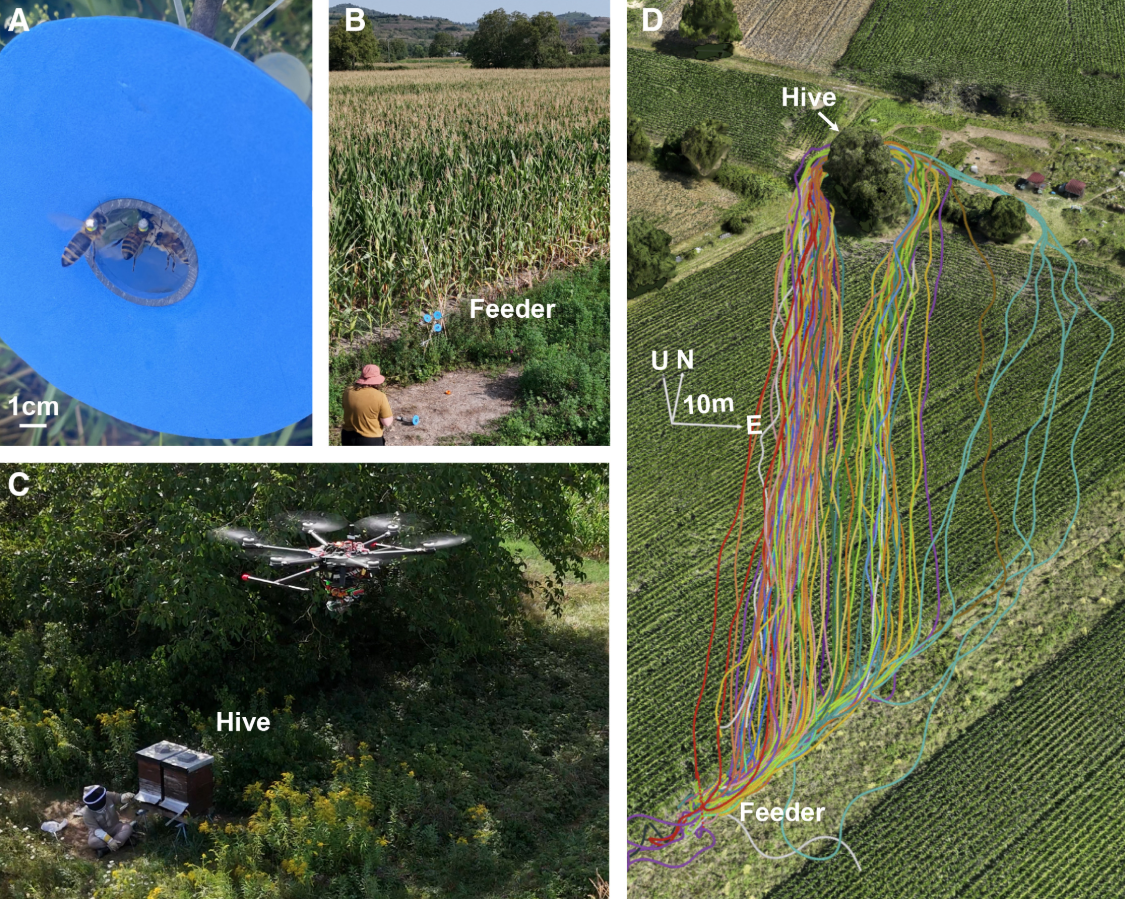
Honeybees routinely fly hundreds or thousands of meters between their hive and established foraging locations.1,2,3 To navigate these long distances, they are known to combine both landmark use4,5,6,7 and path integration8,9,10,11 and have been hypothesized to build a cognitive map.12,13,14 Due to technical challenges inherent in tracking these small insects, obtaining three-dimensional, high-resolution measurements of individual navigational precision, and thus a detailed understanding of their strategies, has been difficult. Here, we utilize a novel multicopter drone-based tracking system15 to measure the individual flight paths of honeybees in a structured agricultural landscape at unprecedented spatial and temporal resolution.